What Can I see along the Sichuan-Tibet highway Northern Route?
The Sichuan-Tibet line refers to the Sichuan-Tibet Highway, the ancient tea-horse road in history. Due to the rough terrain and high altitude, the Sichuan-Tibet Highway is one of the most difficult roads to built in China's road construction history. The Sichuan-Tibet Highway starts from Chengdu, Sichuan Province and is divided into two lines at Xinduqiao town. The total length of the south line is 2,149 kilometers, running on the G318 Highway. The north line is further divided into two routes, with a total length of 2,313 kilometers.
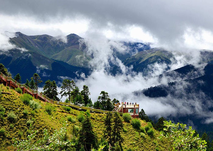
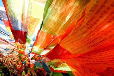
Compared with the south route, the north route via G317 Highway is highly recommended by adventurers. You are sure to be shocked by the icy glaciers tumbling down from jagged peaks through lush forests of spruce, the grand monasteries and temples dotting the hills and the colorful prayer flags displayed everywhere. This route is somehow dangerous but full of cultural landscapes.
You can enjoy both the natural landscape of the south route and the Tibetan culture of the north route by taking the “small north route”. You can depart from Chengdu,and pass through Dujianyan, Sertar County, Ganzi Prefecture, and arrive in Changdu where you can transfer to G214 Highway, connected with the south route. You can not only enjoy the beautiful scenery in the south route, the magnificent view of the snowy peaks, but you can also visit cultural scenic spots including Huiyuan Temple and Wuming Buddhist School, one of the world's largest Tibetan Buddhist studies.
Recommended travel time:
The appropriate time is from April to October each year: from April to June, the ice on the northern line has slowly melted and the temperature slowly rises; July-August is the rainy season in Tibet with frequent mudflow and landslides. If you drive to Tibet at this time, you should leave yourself more time on the road lest your journey be delayed due to traffic jams and traffic control; from September to October, there’s less cars on the highway than in the summer vacation. But, you’ll face cold weather, as some places in Tibet begin to snow.
Highlights:
1.Dujiangyan is an ancient irrigation system in Dujiangyan City, Sichuan, China. Originally constructed around 256 BC by the State of Qin as an irrigation and flood control project, it is still in use today. The system's infrastructure develops on the Min River (Minjiang), the longest tributary of the Yangtze. The area is in the west part of the Chengdu Plain, between the Sichuan basin and the Tibetan plateau.
2. Hailuogou: Hailuogou is the one and only glacial forest hot spring park in China. It is located at the foot of Gongga Mountain. It is a place where you can see the glaciers without worrying about high altitude sickness. The lowest point of the glacier is only 2,850 meters above sea level, the lowest glacier in Asia. In addition to the glaciers, the clouds, red rocks, azalea, golden forest and hot springs are all worthy visiting. In winter, hot springs there are indeed great choice. There’s an ancient town near the valley.
3. Yingxiu and Wenchuan Earthquake Sites: It is also a 5A-level tourist scenic spot, 78km away from Chengdu. The 2008 Sichuan earthquake also known as the Great Sichuan earthquake or Wenchuan earthquake, occurred at 14:28:01 China Standard Time on May 12, 2008. The sites mainly include the memorial hall and the earthquake site of the Xuankou Middle School.
4. Miyaluo Red Leaf Scenic Area, located in Li County, Aba Tibetan and Qiang Autonomous Prefecture,Sichuan Province. In the golden autumn, the spot is filled with golden and red trees. Coupled with the blue sky, white clouds, mountains and rivers, the scene in autumn forms an enchanting picture. It boasts the largest area and the best scenery among China’s red leaf scenic spots. Also nearby are the famous Jiuzhaigou and Siguniang Mountain.
5. Zhuokeji Headman's official Mansion. Situated in Xisuo Village which is 7km to Barkam County, Ngawa Tibetan and Qiang Autonomous Prefecture, Sichuan Province, Zhuokeji Headman’s Official Mansion is a typical Rgyalrong Tibetan building group at the elevation of 2700m and an area of 50000m². Facing south, the whole castle was built according to the hillside topography and acclaimed as “a pearl in oriental architectural history”.
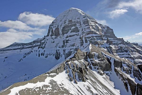
6. Kavalaon Snow Mountain stands in the Luhuo County of Ganzi Prefecture, meaning the king of white snow. The main peak of Shenshan Mountain at an altitude of 5480 meters is covered with snow all the year round.
7. Zongta Prairie is located in the northeast of Luhuo County, in the upper reaches of the Dadu River, 60 kilometers away from the county town. On the broad grassland, there are cattle and sheep in groups, dotted tents, and there are also foxes, marmots and hares that live in harmony with humans.
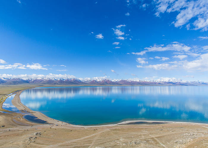
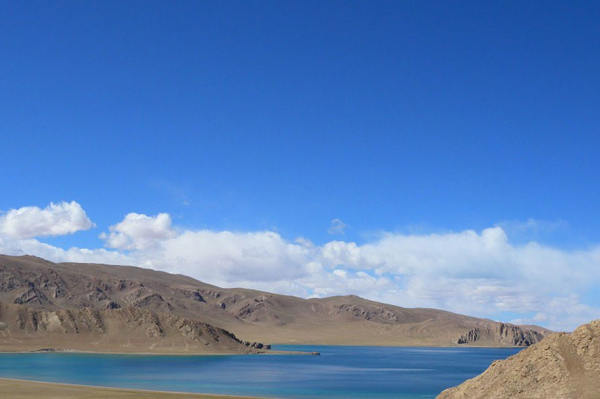
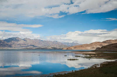
8. Kasha Lake is about 60 kilometers away from Luhuo County. Driving along G 317 Highway to Ganzi, you can arrive there less than 3 kilometers when you arrive at Zhari. The Kasha Lake Reserve is a provincial wetland nature reserve. It is a plateau freshwater lake with an area of only 1.92 square kilometers. It is 3510 meters above sea level. The famous local holy lake is also the largest waterfowl habitat on the north route.
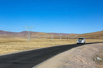
9. Zhaxika Prairie: It is the largest grassland in Sichuan and is also known as the Sun Tribe. It is located at the junction of Sichuan, Qinghai and Tibet provinces, 1070 kilometers away from Chengdu. With an average elevation of over 4,000 meters and an area of over 25,000 square kilometers (about 90% of grassland), it is the largest and highest county in Sichuan Province. It is a veritable "world high city".
10. Manigango is a western-style town. Xinluhai Lake, which means the lake of heart, is only 10 kilometers away from Manigango. There’s a legend that the lake once won the heart of the concubine of King Gesar. It is the highest and largest glacial lake in Sichuan.
11. Chola Mountains: The Chola Mountains, also romanized as the Trola Mountains, are a northern subrange of the Shaluli Mountains in western Sichuan Province. The mountains were once at the centre of the Kingdom of Derge and many remnant Tibetan Buddhist monasteries can be found in the mountain range's valleys.
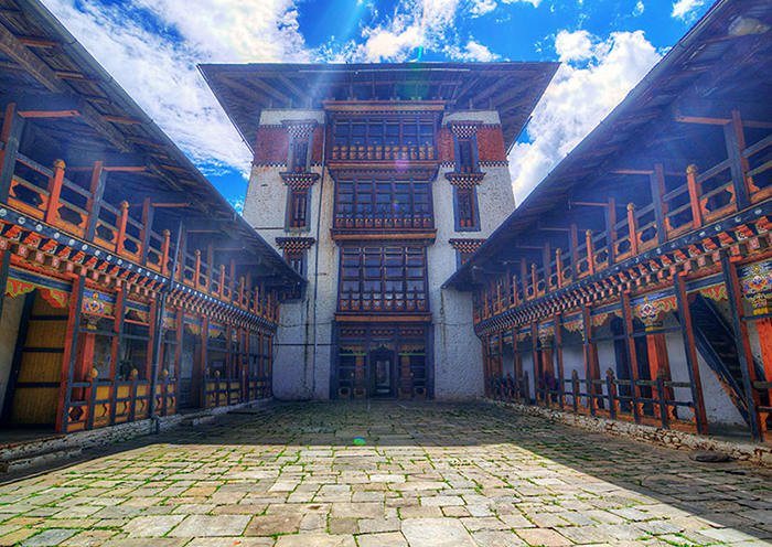
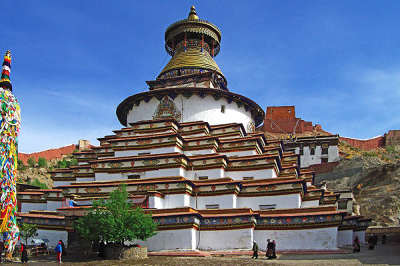
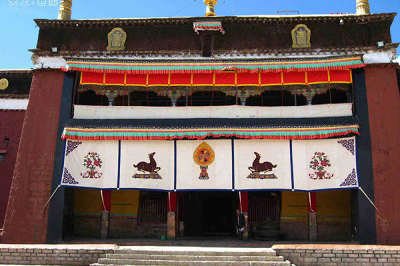
12. Changdu Qiang Bahrain Temple: It is the largest temple in the Kang District. The main buildings of the temple are well preserved. There are hundreds of Buddha statues and stilts in the hall. Thousands of square meters of murals and numerous Thangka paintings showcase the wisdom of the ancient craftsmen in Changdu.
13. Kano Ruins: Located in the Caro District of Changdu City, Tibet Autonomous Region, southwest China, it is a late Neolithic cultural site. The remains are named Caro Culture, located in Karuo Village, about 12 km southeast of Changdu City, Tibet.
14. Bangda Grassland: Located in Changdu of the Tibet Autonomous Region, the Bangda Grassland in the deep valleys is an alpine grassland with a flat terrain and abundant grass. The Bangda Grassland is more than 130 kilometers away from the city of Basu. The Bangda Prairie crosses Bangda Town and Yiqing Township.
15. Bengle Karst Cave: Located at the top of the “Bengle” Mountain in Sanduo Town, Neiwuqi County, at an altitude of 4,300 meters. The “Bengle” cave is gourd-shaped, extending to the top of the mountain. The hole is narrow and can only pass by one person. Then it gradually opens up. The whole cave is divided into three layers. The depth of the cave is 67.5 meters, the width of the hole is 360 square meters, and the highest point of the hole is 16.8 meters.
16. Bujia Snow Mountain: Located at the junction of Dingqing County, Baqing County and Suo County, Changdu City, Tibet, with five fully-developed giant hanging glaciers, it has become the world's most densely hanging glacier.
17. Bhutto Lake: It includes two mountain lakes of different sizes. It is located about 25 kilometers north of Dingqing County, with an altitude of 4560 meters to 4600 meters. The waters of the two large lakes in Bhutto are derived from the nearby glaciers with snow-capped peaks. The terrain around the lake is the high valley basin. The terrain is wide and the pasture is rich. It is one of the rare summer pastures in Dingqing. The fishery resources of the two lakes are also very rich.
18. Zizhu Temple: Located on the Zizhu Mountain in Jue’en Township, Dingqing County, Tibet, it is about 37 kilometers away from the county.
19. Maimo Cave: Located in Baqing County, Nagqu District, Tibet Autonomous Region, it is famous for its strange stone pillars and stalagmites. The peculiar landscape of the cave is full of magical colors due to the rich folk customs and religions nearby. It is one of the must-see landscapes of Tibet tourism.
20. Zandan Temple: it is located in Suo County, Nagqu District: It is the earliest Shamanism Temple in the northern part of Tibet. It is built on the mountain and is divided into two groups of buildings. It looks like the Potala Palace.
21. Ya'an Cave Hot Spring: it is located in Suo County, Nagqu. The spring is deep and clear, and there is a green rock that glows at the bottom, like an emerald embedded in the bottom of the spring. There are colorful fishes in the spring.
22. Yala Snow Mountain: in the Tibetan language, it means the white yak mountain in the east. It is one of the four great mountains in China’s Tibetan areas. Located at the junction of Kangding, Daofu and Danba counties in Ganzi Prefecture, Sichuan Province, it boasts an altitude of 5,884 meters.
23. Xiangxiong kingdom ruins: Located in Nima County, Nagqu District, it is built on the mountainside. It features stone buildings and a large scale. The ancient Xiangxiong Kingdom once stood high in the Qinghai-Tibet Plateau.
24. Tianquan County: It is a county under the jurisdiction of Ya'an City in the west of Sichuan Province in China. It is located at the western edge of the Sichuan Basin, and the upper reaches of the Qingyi River. And the Sichuan-Tibet Highway runs through the whole territory. It is the throat to Tibet and the first county for the ancient tea-horse road to extend westward. Tianquan County is rich in natural resources and has a high forest coverage rate. There are dozens of rare and protected animals in the country, such as giant pandas, golden monkeys, wildebeests and giant salamanders.
25. Luding County: Located in the western part of Sichuan Province, the county is sandwiched between the Lushan Mountains and the Daxue Mountains. The Dadu River runs from north to south. Luding County has a history of more than 2,000 years. Because of the brilliant victory of the Red Army, it has become a famous attraction for tourists from all over the world.
26. Dadu River:it is a major river located primarily in Sichuan province, southwestern China. The Dadu flows from the eastern Tibetan Plateau into the Sichuan Basin where it joins with the Min River, a tributary of the Yangtze River. Measured from its geographic source, the Dadu is actually longer than the Min and thus forms the main stem of the Min River system.The Dadu River marks the transition area between traditional Tibet to the west and historic China to the east. For this reason, it has long been considered a frontier region and has hosted many conflicts.In the 20th century CE, the Dadu became famous for its Luding Bridge, a historically important bridge crossed by the Chinese Red Army while retreating from the Kuomintang troops during the Long March.
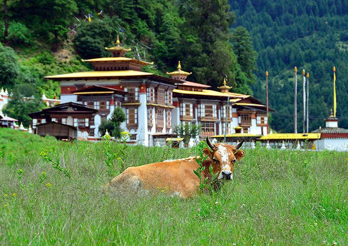
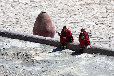
27. Huiyuan Temple: It is the ancient lotus temple at the foot of the Yala Snow Mountain. It is the Gelugpa Temple of Tibetan Buddhism, the highest level temple in Tibetan areas. Every day, local Tibetans circle around the prayer wheel clockwise, devoutly worshiping the Buddha while lamas are meditating and chanting. Please do not take pictures at will.
28. Tagong Grassland: It is a pure pastoral grassland closest to Kangding. The best time to visit is from late June to early August. If you are lucky, you’re able to join in the grand traditional horse racing. It is a great choice for photographers.
29. Tagong Temple: It is an important part of the Tagong Prairie. There are three mountain ranges behind the temple, where the triangular or square-shaped flags dancing along the wind.
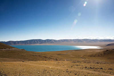
30. Ranwu Lake: In Tibetan, it means “lake like goat milk”. It is a famous plateau glacial lake with an area of 22 square kilometers and an altitude of 3850 meters. The blue lake reflects the lush forests on the lakeside, and the lakes are surrounded by waterfowls.
31. Midui Glacier: Midui Glacier is regarded as 1 of the 6 most beautiful glaciers in China by China National Geography Magazine. It is located in Yupu Town, about 100 km east of the county seat of Bome. Being famous for its grant ice basin, for its frequent snow avalanches, and for its giant ice cascade as long as 700 to 800 meters, it coexists with snow mountains, forests, lakes, villages and temples in harmony. It’s a natural park of glaciers..
32. Bomi County: surrounded by snow-capped mountains, the county features mild climate, abundant rainfall, lush vegetation and no chilly winter or hot summer. It is called “Tibetan Switzerland” and “Snowland Jiangnan”. Located on the east bank of the Yarlung Zangbo River, with an average elevation of 4,200 meters, it is the birthplace of the Kachin Glacier, the largest marine glacier in China.
33. Lulang Scenic Area: LuLang means “Dragon King Valley” in Tibetan language, or “a place that will make you forget your home”. It is located by the Sichuan-Tibet Highway, about 80 km from Nyingchi County. In summer, the flowers will blossom. Also, it is 1 of the best spot to watch the Namjagbarwa (the highest peak in Nyingchi with an elevation of 7782 meters).With an elevation of 3700 meters, Lulang Forest is a typical plateau-mountain-meadow, 15 km long and 1 km wide. Known as a fairyland where gods live in with scenic beauties, it has special breathtaking scenery in every season. You will get lost in the fairy tale. The clouds constantly change their shapes above Lulang Forest. Sometimes they are like galloping horses or leisure yaks.
34. Sejila Mountain: Located in the east of Nyingchi County, it is the watershed of the Niyang River and the Palong Zangbo River. Having climbed up to the 4,728 meters high mountain pass, one will observe the sunrise, cloud sea and boundless forest and the grand Nanjiabawa from afar. The Benrila Mountain near the Daze village at the hillside of Sejila, the holy mountain of Ben, is among the four Tibetan holy mountains. The pilgrimages came here to circle around the holy peak throughout the year.
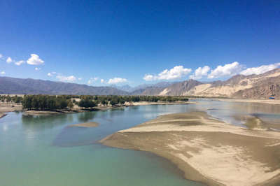
35. Lhasa River: It is a large tributary in the middle reaches of the Yarlung Zangbo River and one of the highest rivers in the world.
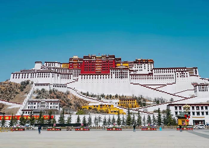
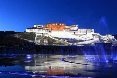
36. Lhasa: The holy place of Tibetan Buddhism, also known as the city of sunshine. It is located in the middle of the Tibetan Plateau. It is the capital of the Tibet Autonomous Region, a political, economic, cultural and religious center with an altitude of 3,658 meters. It is a gathering place for devout believers and a fast-growing city.


 Data in submission...